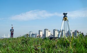
Real Property Reports (RPRs) are indispensable tools in Calgary real estate. Whether you’re a homeowner, buyer, lawyer, or realtor, understanding the details within an RPR can save time, avoid costly disputes, and provide peace of mind.
In this article, you’ll learn how to interpret the key components of an RPR, with insights and practical tips from Alberta Land Surveyor Mark Sutter.
Understanding Real Property Reports
What Is a Real Property Report?
A Real Property Report (RPR) is a detailed land survey document that provides an accurate snapshot of a property’s legal and physical boundaries, the locations of permanent structures, easements, and any potential encroachments.
As Mark Sutter notes, “An RPR is a snapshot in time reflecting both legal and physical realities.”
Key elements shown on an RPR include:
- The property’s legal description and civic address
- Surveyed boundaries, typically marked as solid lines
- The positions of visible permanent structures such as houses, garages, fences, decks, and sheds
- Identified encroachments where property boundaries or easements are crossed
A crucial part of any professional RPR is the stamp and signature from a licensed land surveyor. This certification assures the survey work and the report’s content are accurate to the conditions observed on the date of survey, following professional standards and best practices.
Why Is a Real Property Report Important?
A Real Property Report (RPR) is essential because it gives all parties clear, detailed information about a property’s boundaries, structures, and any potential issues, such as encroachments or proximity to easements.
For buyers, sellers, realtors, and lawyers in Calgary, the RPR plays a critical role in facilitating real estate transactions and reducing risk by providing the following:
- Boundary Clarity: An RPR clearly indicates where the legal property limits are, helping to prevent unintended encroachments onto a neighbor’s land. This clarity can head off disputes down the road and is often required by lawyers to affirm clear title.
- Transparency and Due Diligence: By showing the location of fences, sheds, garages, and other permanent structures relative to property boundaries, the RPR allows everyone involved to see what’s actually on the property. This transparency is invaluable during the buying and selling process, when full disclosure of the property’s condition is critical.
- Identification (But Not Guarantee) of Compliance: While a professionally prepared RPR includes a certification from a licensed land surveyor stating the survey’s measurements are accurate as of the date of survey, it does not guarantee the property complies with all municipal bylaws or regulations.
The RPR helps identify potential compliance issues, but only the municipality can certify legal compliance through a separate review and a Certificate of Compliance. - Peace of Mind: Sellers and buyers can approach property transfers with greater confidence, knowing the RPR makes all known issues — such as encroachments into municipal easements or additions without permits — visible up front.
The RPR is essential in property transactions, giving all parties clear information about boundary locations, potential issues, and what’s actually present on the property. This helps identify, but does not resolve, compliance concerns or encroachments which may affect ownership or future development.
How to Read a Real Property Report
Key Components of an RPR
When you look at an RPR, you’ll see a map-like drawing with several key parts. Here’s what to look for:
- Title Block: This is usually in one corner. It includes the property’s civic and legal address, certificate of title, date of survey, and sometimes a note about existing caveats or encumbrances.
- Survey Boundary: The solid lines on the RPR outline the exact legal limits of your property.
- Permanent Structures: The report shows all visible structures — like your house, garage, sheds, fences, and decks — mapped against these boundaries, so you can see how everything fits to the lot.
- Encroachments: These are spots where a building, fence, or structure crosses a property line or encroaches into an area where it shouldn’t, such as a city right-of-way.
- Right-of-Ways: Indicated with dashed lines, these are paths or zones for utilities or municipal access and must remain open and cannot be blocked by permanent structures.
- Surveyor’s Notes: You’ll often find small notes or symbols on the plan. For example, if a fence is within 20 centimeters (about 8 inches) of a property line, it’s labelled to show closeness — but there is no intent to state ownership of the fence.
Tip: Focus on the legend or key provided on the RPR. It explains what every line and symbol means, so you aren’t left guessing.
Steps to Interpret Your RPR
Analyzing Property Boundaries and Structures
Start by matching the boundaries shown (the solid lines) to the real physical boundaries on your property. Here are some quick checks:
- Garages and Sheds: Check they don’t cross over the property line and they observe the city’s setback rules.
- Decks: Measure from the edges of your deck to your property boundary lines. By Calgary bylaw, a deck taller than 0.6 metres (about 2 feet) must be at least 7.5 metres (about 25 feet) from your rear property line.
- Concrete or Interlocking Bricks: Not every surface is shown — only those which are considered permanent parts of the property.
Identifying Easements and Encroachments
Some of the trickiest problems show up here:
- Easements: If your property has a dashed line through it, this usually means there’s a utility or city access path called an easement. Permanent structures aren’t allowed here, and even fences may be restricted.
- Encroachments: These are common sources of stress for owners. Examples include:
- A fence which extends beyond the property boundary into the street.
- A garage or shed that extends into a utility easement.
Either case could mean you’ll need to get a special permit called an Encroachment Agreement, or you may be required to move the structure.
If you spot any potential issues, check the notes on the RPR and consider getting professional advice — especially before buying or selling property, as unresolved encroachments can complicate a sale.
RPR Reports and Their Role in Real Estate
In Calgary, having a current and clear RPR gives everyone confidence in a transaction. Mortgage lenders, lawyers, and realtors will almost always ask for one — particularly in conditional sales — because it shows exactly what is on the property and where it sits relative to legal boundaries.
A well-prepared, up-to-date RPR helps ensure negotiations go smoothly and prevents surprises which can slow down or derail a deal.
How to Obtain an RPR in Calgary
To order an RPR, you need to contact a licensed Alberta Land Surveyor. At Third Rock Geomatics, Mark Sutter and his team use clear, client-friendly plans and offer quick turnaround — typically within 3-5 business days.
Costs and Considerations
Real Property Report Calgary Cost
A standard RPR in Calgary typically costs between $500 and $800, but the price can be higher if your property is large, unusually shaped, in older neighbourhoods or has complex features. Rush services and extra details (like boundary staking) can add to the price.
Factors Affecting RPR Pricing and Services
- Size of your lot and number of structures to document
- Past renovations or changes that may need special attention
- Complexity of utility and municipal easements
- Any compliance or encroachment issues which need resolution
Professional Guidance When Reading Your RPR
How Third Rock Geomatics Can Help with Your RPR Needs
Third Rock Geomatics provides easy-to-read, fast, and accurate RPRs designed with homeowners in mind. With decades of local surveying expertise, our team provides a stress-free experience from start to finish — answering your questions and making sure you have a document everyone can understand.
Need an RPR for your Calgary property? Contact Third Rock Geomatics today!